
I start this blogpost with a little homage to the Wine of Chile.
It is great and cheap and comes in handy boxes.
Now I know drinking wine in a box is very uncouth but Jules and I have to admit that we have been drinking copious wine from cardboard here. It is much easier to carry on the bike and it tastes really good! Though we are not sure if it is just that the Chilean wine is that good, or that our standards have been reduced by our time on the road. Either way, we have gotten quite used to our evening tipple at some beautiful campsite overlooking a lake or river.
Now if that is not enough reason to entice you to come cycling in Chile (and it should be), then images of the Lakes District of central Chile will have to do.


Jules and I wandered on a kind of random path through the lakes area – we were originally going to cross into Argentina and head through the lakes district on that side of the Andes but we had heard reports that the ash from the volcanic explosion was still causing problems and we wanted to spend more time in one area rather than just whizzing through. Besides, to be honest, we were having far too much fun in Chile to leave.
 We had thought up a sort of general route through the back roads of the Chilean Araucanian and Lakes district, but this changed every day, and sometimes even hourly if a local happened to recommend a potential route to us. Our wanderings through the lakes district took us to hotsprings, past a number of volcanoes, up through forests of the unusual Monkey Puzzle trees, over lava fields, alongside numerous lakes and to old German settlements.
One of our most enjoyable sections was the River Biobio valley. Generally its a bad idea if the area you are heading into does not have any roads leading out of it, but this didn't stop us deciding to explore the River BioBio. We had read about a cyclist that had passed this way and then used a horse-trail to connect to roads further south and we decided that it sounded suitably foolish enough for us to attempt. When we reached the end of the valley, and with a bit of local advice, we found a foot trail down to the river, then a narrow pedestrian bridge over the river,and a very steep and rocky horse track up from the bridge that we had to two-man push our bikes up in stages. The horse-trail then widened slightly and we could ride sections of it but overall the next 7kms involved a lot of pushing - up to the top of a little pass. We then crossed down into another river valley where we found a 4wd track and eventually connected up with a gravel road. Not our easist of routes but definitely one of our favourites. We had found ourselves in an area with no road connections, only forests and farms and views of the surrounding snow-capped volcanoes, lakes and creeks.
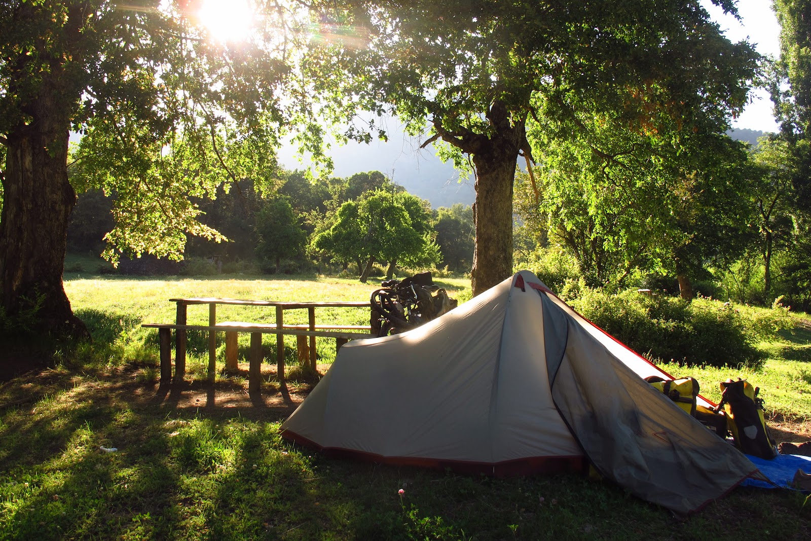
Our progress through the lakes area was mainly influ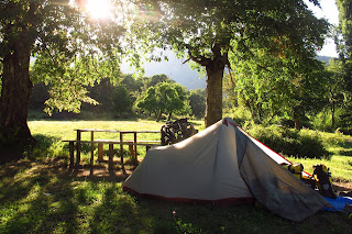 enced by the fantastic campspots that we found. Almost every night we were camped either beside a picturesque river or a lake and we often gave up on a day`s planned ride when an opportunity to contemplate life beside a river presented itself. Usually we asked the locals where we could camp and they would point us in the direction of some great spots. Lots of the little towns had either a farmers field or a spot next to the river where the locals camped, and sometimes people would open up their gate for us and direct us to a fantastic river/lake frontage, often complete with a picnic table!
 enced by the fantastic campspots that we found. Almost every night we were camped either beside a picturesque river or a lake and we often gave up on a day`s planned ride when an opportunity to contemplate life beside a river presented itself. Usually we asked the locals where we could camp and they would point us in the direction of some great spots. Lots of the little towns had either a farmers field or a spot next to the river where the locals camped, and sometimes people would open up their gate for us and direct us to a fantastic river/lake frontage, often complete with a picnic table!
 Now I know this blogpost has been a little bit gushy and crammed full of superlatives, but I just can`t help myself. Jules and I floated through the lakes district on a little cloud of cycling (and wine) happiness. We luxuriated in fields of daisies, in the hues of roadside lupins, and the beauty of the climbing wildroses alongside the road. It would have been too good to be true, except these gasp-worthy scenes of Spring flowering also helped induce terrible attacks of allergies. So I was riding past stunning vistas with a continually running nose, itchy red skin, and swollen puffy eyes. Just to bring me back down to earth.
The sublime weather came to an end as we arrived in the southern reaches of the lakes district, and we received a healthy dose of rain. Our first spot of bad weather for a very very long time...and a good chance to hide up in the touristy town of Puerto Varas to work out the next part of our trip – heading south into Patagonia.
 Notes for cyclists.
Some people are under the impression that you have to stick to the main highway in Chile, but it is quite possible to travel all the way through this section using smaller roads and backroads. It involves a lot of zigzagging, but it is worth it to avoid the Panam and enjoy the countryside. Just get a good map and connect up the roads!
We left the Panam at Chillan and headed south through Pemuco, Yungay and Quilleco – this is all on asphalt. There is a great municipal campsite at Yungay – just before you get into town as you head over a bridge. It is on the east side of the road, right next to the river. Very pretty camping spot with picnic tables– no-one there when we were there (except the family that caretake it). And free!


The tourist office in Ralco told us there was a new bridge across the river that would connect up to roads further south but none of the other locals knew about this! When we arrived in Leroy Ralco, towards the end of the lake, we asked around and got pointed in the direction of a pedestrian bridge over the river. We had to push the bikes down a foot path to the bridge, then 2-man push the bikes back up on the other side (steep rocky trail!) for a few hundred metres (it felt like forever) to connect up with a slightly wider horse trail. This trail is partly rideable but most of it was too steep and rocky for us to ride and we ended up pushing most of the 7km up and over the pass. Ask the locals in Leroy Ralco about the trails, they are over private land so we asked permission from a couple of people (hopefully the right ones) as well. At one point the trail forks into two – the right hand starts going up more steeply and this is the fork you want. The left fork goes towards some poplars,and a farmhouse (really nice family, I asked them if we could pass through their farm and they showed me the right way). Once over the pass the trail gets a little wider and eventually becomes more of a 4wd track, and then eventually turns into a gravel road (through a gate) and finally you join up with an actual road that was marked on our map. We went left towardsTroyo (friendly town, with a great farmer's field to camp in next to the river). It was about 21kms from the top of the pass to Troyo, the first section all down but most up and down along the river.

We then headed towards Lonquimay, then Liucura (pretty and easy riding) and then back to Curacautin (where we had to get something fixed on the bike). After Curacautin we went up through the Conguillo National Park, which was a great ride!. The first 10kms from Conguillo was asphalt and then it turns to ripio, and the ripio gets rougher the closer to you get to the park. It is 4000 pesos to enter the park, and it is a really pretty ride up through the Monkey Puzzle trees, nice lake – the road includes ripio, sand, washboard.. it has it all! The camping in the park is really expensive but the park rangers told us to camp at the southern entrance station, which was a good little spot, we spent al day in the park and then headed out at the end of the day.
 Asphalt, quick riding Melipeuco to Cunco. Then we turned onto the “Interlagos” Route – where we got a little lost and when a long way but ended up on a hilly ripio ride over to Villarrica. Villarrica was the most touristy area that we went through.
We then connected south past Lican Ray and Panguipuilli. Then we headed towards Los Lagos which was a pretty quiet road. We were on the Panam for about half a day, then went along the road to Lago llanquihue. We really enjoyed the section after La Cascada which goes through the national park at the base of Volcan Osorno. Then nice, easy (but still hilly – no flat riding along lakes in the Lakes District!) along the other lake shore into Puerto Varas.
** Great bicycle shop in Puerto Montt - Oxford Bikes, very helpful staff
** Great bicycle shop in Puerto Montt - Oxford Bikes, very helpful staff

thanks for your update, and.... happy new year. It will also be for you a strange and different new year, we wish you all the best. Where are you now.
ReplyDeleteHi guys - Feliz año nuevo! It's amazing to see where you are, we are very jealous. Hope that you enjoyed your second Christmas on the road. It's a fantastic achievement and we're frankly gobsmacked at your adventures. Lots of love, Charlotte and Ned xxx
ReplyDeleteHello "Australian Girls" as everybody calls you,
ReplyDeleteVery inspiring route you chose. Good to know about as the route through the Argentin area is probably better to avoid because of the vulcano ash.
Thanks and happy rides
Chris
Wow thrilled to hear you are still having such a great time. We also loved the Lake District of Chile, it gets even more beautiful further south. Keep having fun and peddle safely
ReplyDeleteAll the best for 2012
Janet and Tom
Great photos, Chile looks surprisingly similar to BC. Hope your bikes are holding up under all of the miles, and hope to have a glass of boxy wine with you when you're traveling through BC again...
ReplyDeleteMike, Andrea, and Nathan